Hiking Hvar offers routes for every level — from short coastal walks to full-day mountain crossings.
Below is a quick overview to help you choose the right trail before the detailed descriptions.
Hvar Hiking Trails – Quick Overview
| Trail | Time | Difficulty | Best For |
|---|---|---|---|
| Stari Grad Plain | 1.5–3h | Easy | history & relaxed walk |
| Stari Grad → Hvar | full day | Challenging | panoramic crossing |
| Saint Nicholas Peak | 5–7h | Challenging | highest viewpoint |
| Kabal Tunnels | 2–3h | Moderate | unique & historical |
| Jelsa → Vrboska | 1.5–2h | Easy | coastal walk |
| Jelsa → Vrisnik | 5–6h | Moderate | rural landscapes |
Best Trails on Hvar Island
Stari Grad Plain Walk (Easy Hike on Hvar)

Distance: Flexible (1.5 – 3 hours)
Difficulty: Easy to Moderate
The UNESCO-protected Stari Grad Plain is a treasure of archaeological and natural beauty. This maze of small roads, fields, and family farms is dotted with signs explaining the Greek influence on the island. While hiking through this picturesque landscape, you’ll pass ancient ruins and have the chance to stop at family-owned restaurants offering delicious Dalmatian cuisine and wine. This is an ideal hiking trail in Hvar for those who enjoy a leisurely walk, with plenty of opportunities to take in the island’s history and enjoy local delicacies.
Not to mention, the hiking path is as flat as an open palm. The only elevation is climbing on a bench to see further distance.
It starts either in Stari Grad or in Vrboska. Which route you’ll take depends on your curiosity and the time you want to spend walking around. And the same route you can do on a bicycle. There are plenty of rental agencies on the island. I’m sure you’ll find them easily.
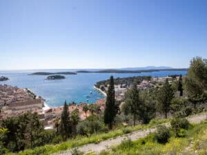
Stari Grad to Hvar Town Trail (Full Island Crossing)

Distance: 7-8 hours
Difficulty: Challenging
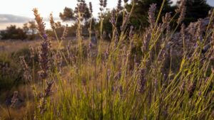
This is one of the more demanding ways to hike Hvar. It takes you across Hvar from Stari Grad to Hvar Town, or vice versa. It’s a challenging 7-8 hour trek that will reward you with incredible views, including lavender fields, old villages, and secluded beaches. Along the way, you may come across locals who might offer you a glass of homemade wine. It’s a full day of hiking, swimming, and immersing yourself in Hvar’s stunning natural beauty.
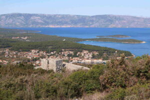
The trek combines a few smaller ones. From Starigrad, follow the shoreline to the ferry port. Pass it, and pass the hotels after. And when you get to the first bay, go uphill. It’s fairly easy to find the trail going uphill, and after 45 minutes of walking, you’ll wish you were an eagle. Sights will open up! UNESCO-protected Stari Grad Plain will open up on the horizon. Biokovo Mountain will howl with its beauty from a distance as an untamed queen. And you’ll stand in awe, admiring the beauties of the horizon.
At least, that’s how I feel. 🙂
A great spot for refreshment
You’re halfway through. You’re not, but let’s be optimistic. You’re on high ground and seeing both sides of the island: northern and southern. From there, a beautiful descent towards the south of the island starts. You’ll pass through Velo Grablje, Malo Grablje, and Milna. Eventually, you’ll get to Hvar town. I promise.
Each step offers something spectacular. From terraces, villages lost in time, olive and lavender fields, to round stone houses made by field workers as shelters. Nature is simply put: magnificent!
I went for a walk and ended up hiking around for three days. What can I tell you?! It’s just unbelievable.
Saint Nicholas Peak Hike (Highest Point on Hvar)

Distance: Flexible (5-7 hours)
Difficulty: Challenging
That’s a way to hike Hvar – towards St. Nicholas! It’s the highest point on Hvar Island, 628 meters. The trail from Starigrad to Saint Nicholas is demanding, with a steep ascent that rewards hikers with breathtaking views of the island, the Adriatic Sea, and even Italy (on clear days). The route is particularly stunning in winter, with crisp air and panoramic sights. Prepare for a long day of hiking, but the experience of standing on the highest peak is well worth it.
There are numerous ways to get to the northern side of the island.
So I’ll simplify it as much as I can:
- From the east (Jelsa): over the villages Svirće, Vrbanj, and Dol.
- From the north (Stari Grad): the first option is to Dol. The second is to take a route towards Hvar (explained above), and when you’re on the highest point, instead of going downhill (south), go southeast. From that point, you can even see the highest peak in the distance. To get back, go over to the village of Dol.
Kabal Tunnels Trail (Historic Hiking Route)

Distance: Flexible (2-3 hours)
Difficulty: Moderate
The Kabal trail is a fascinating mix of nature and history. Starting from Starigrad, this trail takes you through hidden beaches, Mediterranean shrubs, and a Cold War-era tunnel system. The tunnels, used for military purposes in the 20th century, add a unique historical twist to this scenic route. Don’t forget to duck when entering the tunnels, as bats make their home in the cool, dark spaces.
For those who lack thrill, there’s an underground system of tunnels you can dive into. But I’ll leave that for an article about the caves on Hvar Island.
Jelsa to Vrboska Coastal Walk (Easy Route)

Distance: 5 km (1.5 – 2 hours)
Difficulty: Easy
This coastal route is perfect for a morning or evening walk, offering stunning views of the sea and neighboring islands. The walk is relatively easy, and it’s ideal for those looking for a relaxing experience. You can stop for a swim or enjoy a picnic with spectacular views. This route is especially magical when the stars shine brightly over the horizon.
Jelsa to Vrisnik Trail (Rural Landscape Hike)

Distance: 5 – 6 hours
Difficulty: Moderate
I go there quite often. It’s really, really cool!
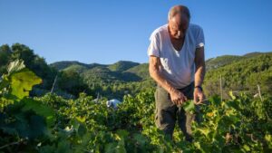
This picturesque trail takes you from Jelsa to Vrisnik, passing through vineyards, olive groves, and breathtaking landscapes. The route is called “Over the Indian” due to a large rock formation that resembles an Indian’s head. It’s a beautiful hike and a great spot for birdwatching and nature photography. On a clear day, you can see the distant Bikovo mountain and the Adriatic Sea stretching before you.
Personally, it’s one of the most interesting Hvars hiking trails. Even though it’s quite well marked, halfway through the bushes and trees might surprise you bit. You’ll spend some time looking for the markation there. But that’s how I hike Hvar most of the time, through bushes. What can I tell, either push through or book our hiking tour, and let me do all the hard work.
More Hiking Routes on Hvar

Hiking Hvar is possible almost year-round, but spring and autumn are the most comfortable seasons. There are many other wonderful hiking trails on the island, such as the one reaching Tor. A hill fort located above Jelsa. Or Galešnik, another wonder from the Middle Ages also above Jelsa.
If you’re staying in Hvar Town and want routes you can start on foot, see the Hvar Town hiking routes.
Hiking Tips for Hvar
Offline maps recommended.
Summer hikes require an early start due to the heat.
Carry at least 2–3 liters of water.
Trails are rocky — wear proper shoes.
Many routes have little shade.
Conclusion
Use this overview to choose the right trail — then you can explore each area of Hvar in more detail.
From the peaceful UNESCO Starigrad Plain to the exhilarating ascent of Saint Nicholas. There’s something for every hiker. For those looking for even more adventure, off-road biking routes and historical sites, such as the Kabal tunnels and ancient Greek-Illyrian fortresses, await.
Hiking With a Local Guide
If you prefer not worrying about navigation, water supply, or route conditions, you can also join a guided hike.
That way, you can simply focus on the landscape while someone who knows the terrain leads the way.